The time has come for a over of our mapping services to clear the way for further development of handy tools for our users. As such, this month we have rolled out a new map format to better allow our users to quickly peruse mining claims by disposition.
In order to keep the maps as clutter free as possibly, we have replaced all button text with icons. Some new buttons will be popping up in later versions, but for the moment, we will give a quick overview of the tools you have at your immediate disposal:
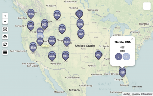
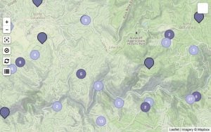
![]() Location Markers come in two different flavors: claim markers and geography markers. Both are fairly intuitive: claim markers indicate the location of specific claims, while geography markers present a general overview of a state, county, or township. Claim markers are different colors to represent their disposition—active or closed. The geography markers use this same color key to indicate how many claims of each disposition are in any one state, county, or township. Hover on the main marker to see the marker expand with details.
Location Markers come in two different flavors: claim markers and geography markers. Both are fairly intuitive: claim markers indicate the location of specific claims, while geography markers present a general overview of a state, county, or township. Claim markers are different colors to represent their disposition—active or closed. The geography markers use this same color key to indicate how many claims of each disposition are in any one state, county, or township. Hover on the main marker to see the marker expand with details.
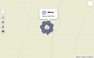
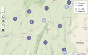
There can be multiple claims on the same location—as different claims may have been active at different times. These overlapping claims will appear grouped together with a number describing how many claims are on that location. Clicking on this marker will split them apart so that you can explore them individually. Figure 3 demonstrates 7 overlapping claims that have been expanded for individual perusal.
![]() Layer control appears on the upper right corner of the map and allows users to toggle map views as well as location marker visibility by claim disposition. While we show a topographic base map by default, you can switch to a satellite view by hovering over the layer icon and selecting “Satellite.”
Layer control appears on the upper right corner of the map and allows users to toggle map views as well as location marker visibility by claim disposition. While we show a topographic base map by default, you can switch to a satellite view by hovering over the layer icon and selecting “Satellite.”
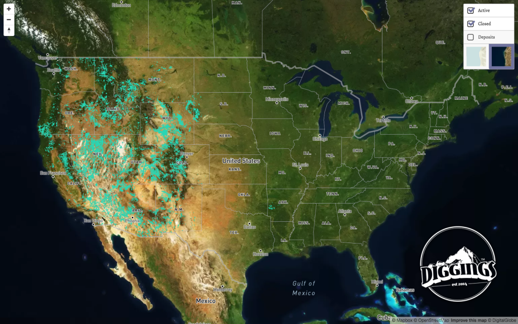
Along with controlling what type of map you see, claim level maps will allow you to show / hide claim markers by disposition. Geographic area markers summarize the number of claims in a given state, county, or township. Once you are zoomed into a more detailed section of the map, you can start exploring individual claims. In this claim level map, you can toggle the visibility of markers by their disposition—open, pending, or closed. If you are looking for potential areas to stake a new claim, you can avoid being distracted by active claims while you are perusing closed claims, but a simple click can make active claims visible again so that you can confirm that there are no overlapping claims that have been staked since the claim you are interested in was closed.
 Geolocation allows you to quickly focus on your present location. The first time you use this, your browser will ask permission for the website to access your location data. You will need to grant permission to be able to use this feature.
 Full Screen optimizes the map viewing process. Rather than just filling the browser window, pressing this button will fill the entire computer screen with the map. Once you are done, simply press the “ESC” (escape) key to return to your original browsing view.
 Refresh updates the contents of your map based on your current view. If you are zoomed out so that you can see the entire country, pressing refresh will present markers for each of the states that contain mining claims. The more one zooms into the map, the more detailed the markers, from states to counties to townships to individuals claims.
 Map Legend explains the significance of different colored markers on the map. We use different colors for active and closed markers. In case you loose track of what is active and what is closed, you can always open the map legend for a quick refresher.
Start exploring for yourself: US mining claims
Given that this is a whole new take on our maps, we know there may still be some little problems that may pop up. Don’t hesitate to contact us with any thoughts, suggestions, and concerns you may have in the comments.