23579 North Bloomfield Road
Nevada City, CA 95959
Phone: (530) 265-2740
email: [email protected]
Malakoff Diggings Website
California State Parks Website
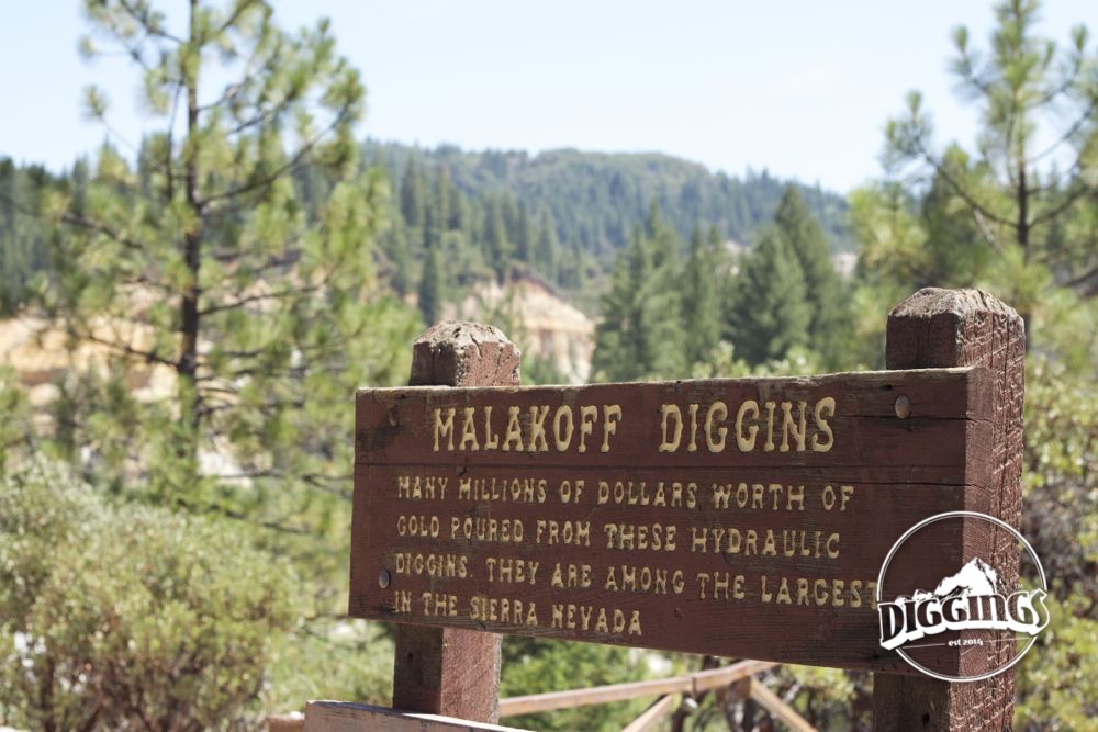
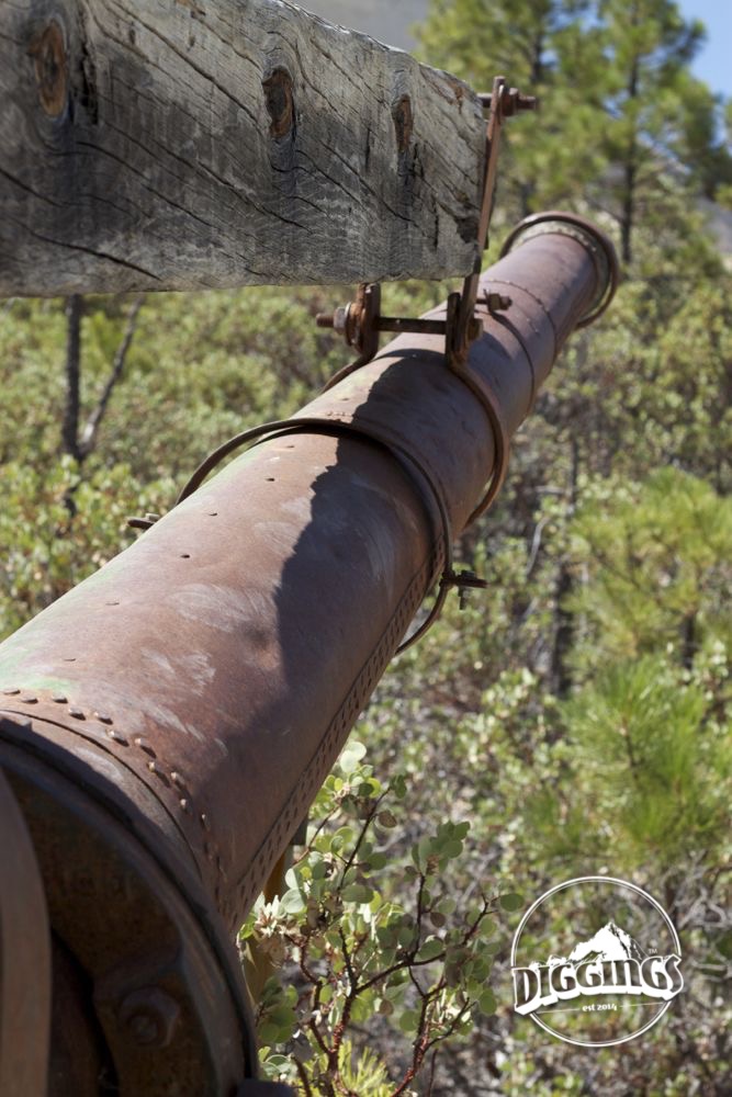
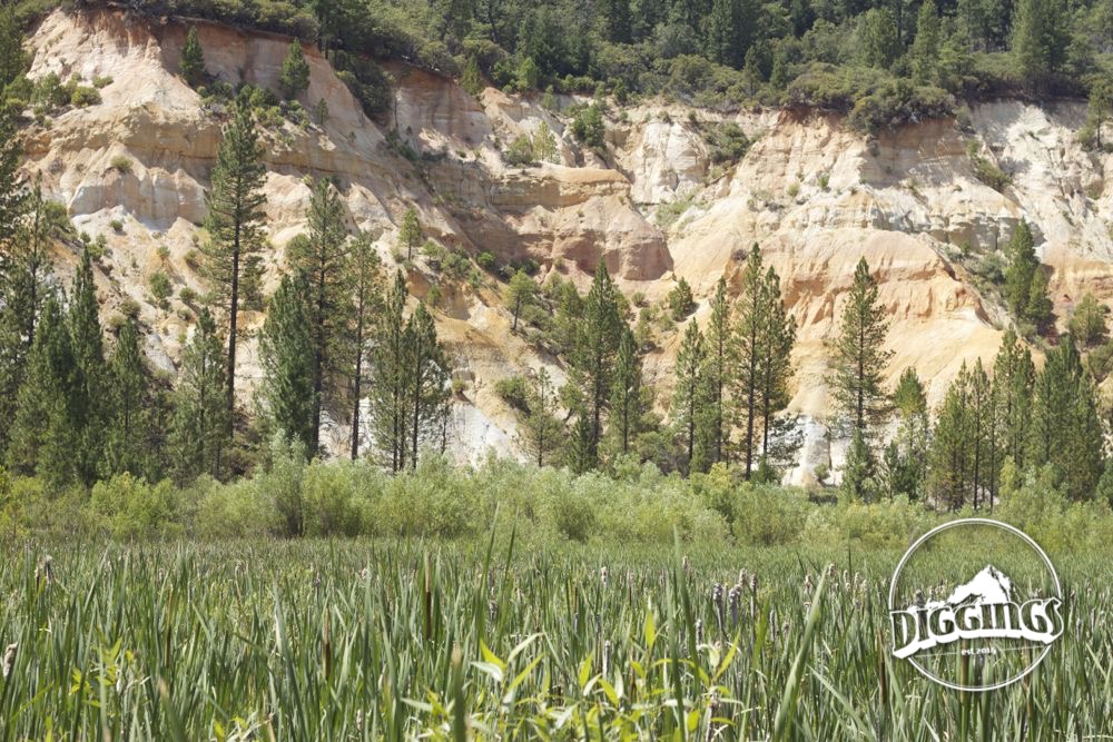
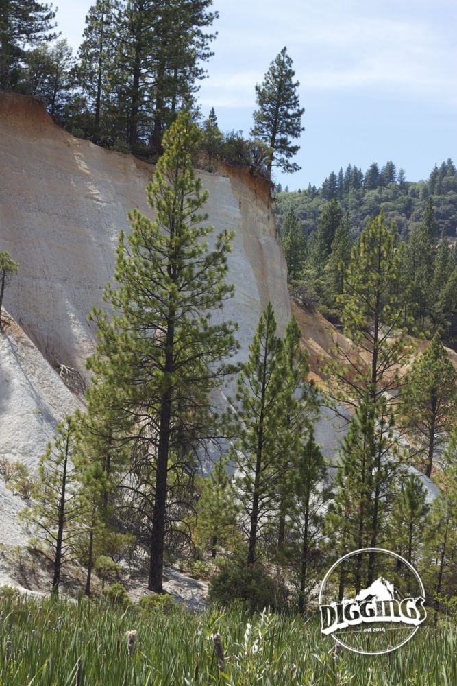
Malakoff Diggins was California’s largest hydraulic mine. While the location had been visited by smaller scale miners before attracting the investor money needed to embark on a large hydraulic mining operation, early forays with pick, sluice, and pan were met with mixed results, earning the area the name “Humbug.” It was the invention of hydraulic mining in 1853 that brought the town new life. Miners could channel river water into progressively smaller pipes to create high pressure water cannons. These cannons could then erode cliff sides, exposing new gold deposits to be processed. Yet, even this new technology didn’t protect small operations from the lean years when droughts meant there was not enough water to created the needed pressure to use the water canons.

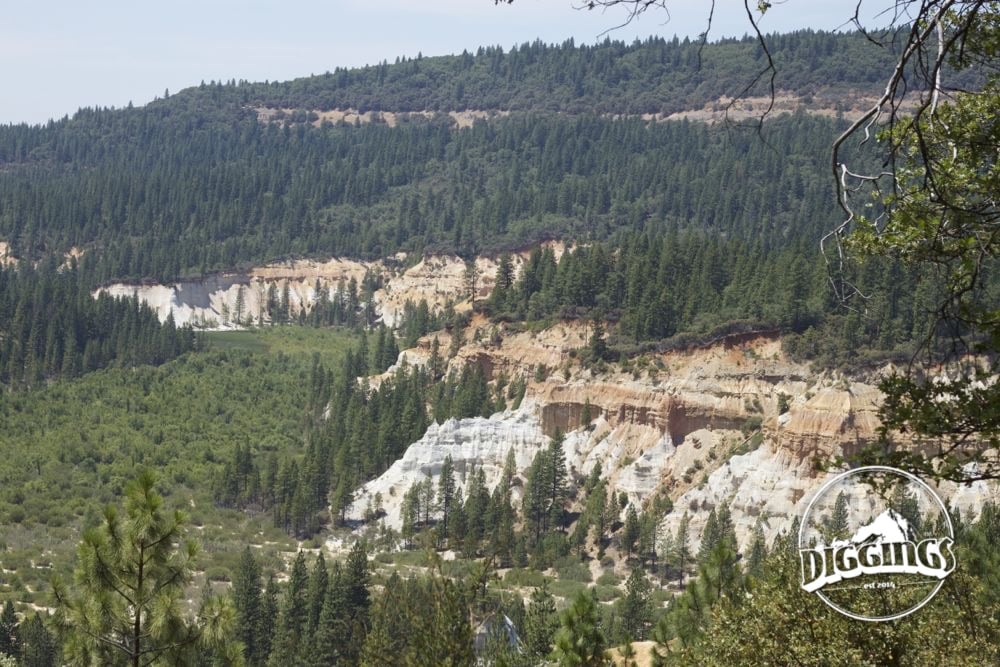
In 1866, the North Bloomfield Gravel Mining Company bought and consolidated the lots. To solve the water challenge, they invested in a massive system of water ditches, directing water from grazing lands far in the mountains. Though this proved highly successful for the company, it had devastating effects on farm land and towns down river in the Sacramento valley. Levies failed, dams gave way, and fields were flooded. Despite protests from farmers and residents, it wasn’t until the fall of 1882 that Edward Woodruff brought a successful suit to stop the hydraulic mining operations. It took two years of litigation, but judge Judge Lorenzo Sawyer found that, while water cannons would continue to be allowed, all debris from mining would have to be stored away by the miners and not washed away down stream. The Sawyer Decision made it too expensive for most miners to continue hydraulic mining. Even those that did, found their marginal profits dwindling.
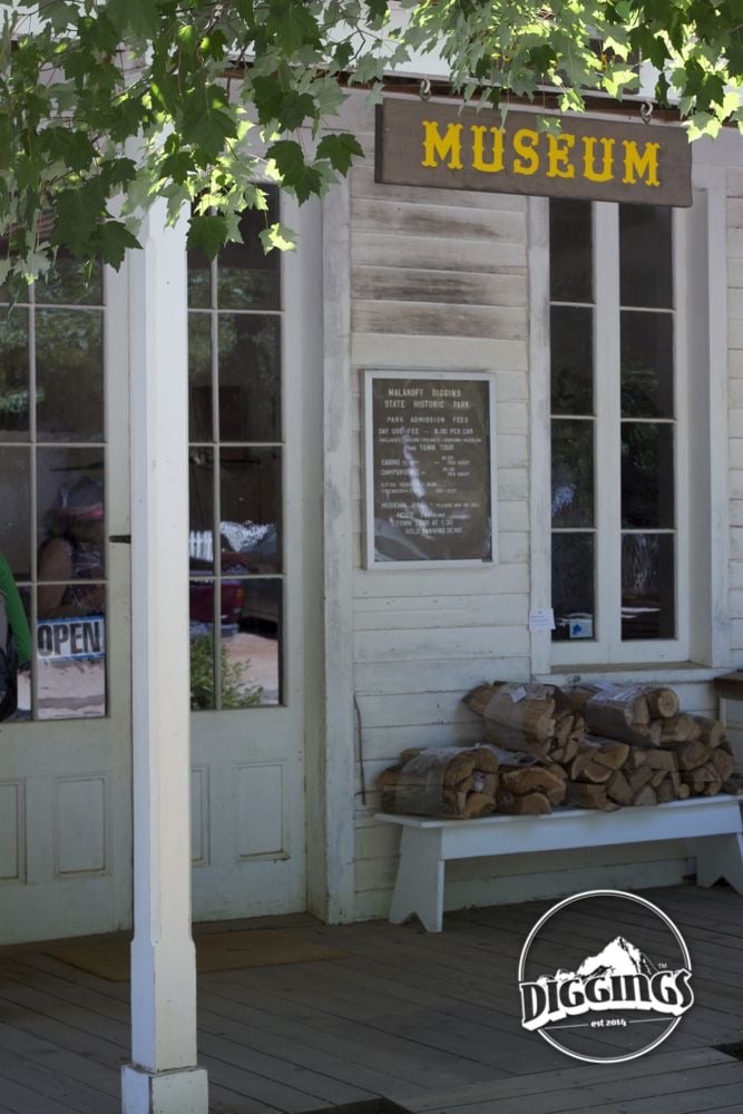
In 1965, the Malakoff Diggins became a California State Historic Park. Visitors can enjoy learning from the highly knowledgable park rangers or trekking through the park on a network of hiking paths.Though these diggings were the site of a major ecological disaster, the resulting bare cliff sides are breathtaking while observed on the Diggings Loop Trail. Allow yourself two hours to complete the loop. You won’t want to miss the final leg, crossing a boardwalk through the marsh below the cliffs.
It is worth checking ahead to find out if there will be a tour of North Bloomfield, the small mining town that popped up around the mining activity at the Malakoff site. Park rangers will give a history of the diggings and town. This is the only opportunity to walk into these historic buildings.


The park also offers 30 camping spots at the Chute Hill Campground, some with breathtaking views of the scoured valley below. Reservations can be made in advance through http://www.reserveamerica.com.

The park does allow panning, however, it is restricted to a short length of Humbug Creek. Shovels and other tools are not allowed. The name “humbug” is a relevant indicator of how much effort should be exerted in a serious pursuit of gold.


The Chute Hill campground at Malakoff Diggins is a favorite of campers across the Sierra Nevada region.